Bioko Island
One of the last strongholds of the drills.
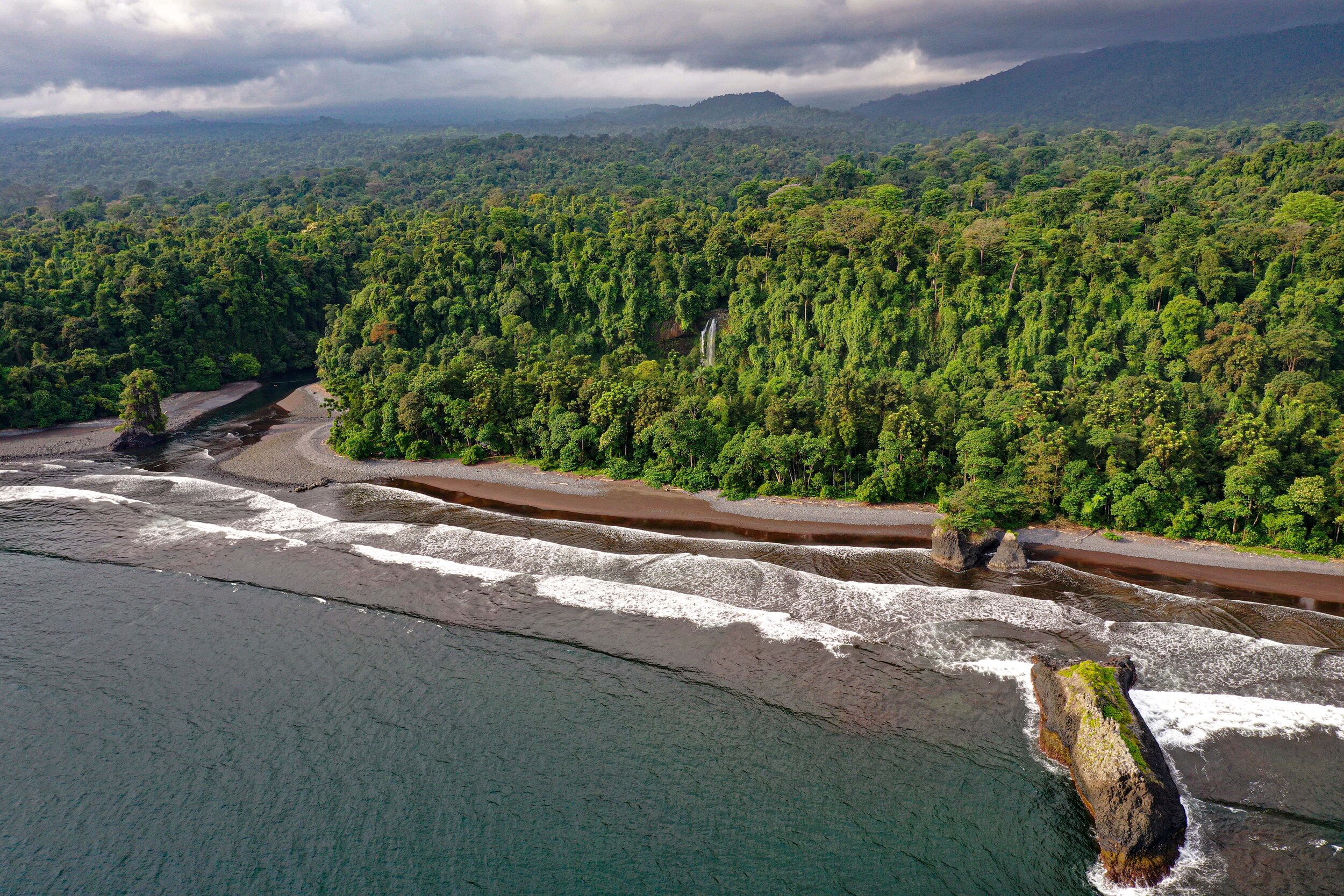
Located in West Tropical Africa, Equatorial Guinea occupies a total area of 28050 km2, divided into two regions: Río Muni, the continental mainland with an area of 26017km2, and Bioko Island, located 32km off the coast of Cameroon. The “island region” comprises Bioko with an area of 2017km2 and Annobón with 17km2.
Bioko is mainly divided into two large massifs separated by the Musola depression: The North Massif, where the highest peak in the country is located (Pico Basilé, 3012m) and the South Massif, with two areas defined by inactive volcanoes: Pico Biao ( 2009m) in the East and the Gran Caldera de Luba (2261m) in the western part of the island. Bioko Island is made up entirely of basalt rocks and volcanic ash.
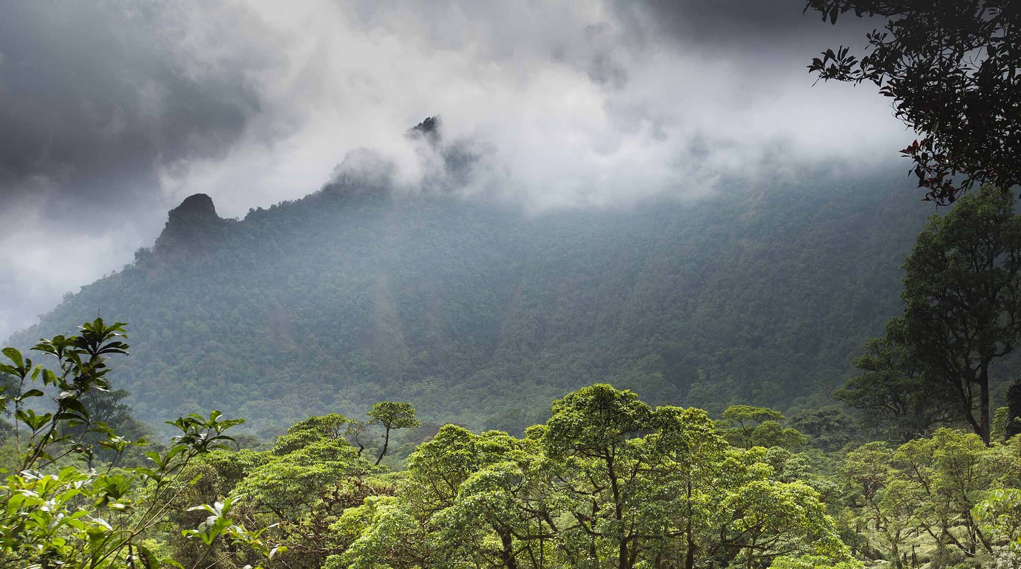
Bioko presents a landscape with great variations both in height and in vegetation characterized by large valleys and elevations with some of them reaching upwards to 3011 meters in the Basile peak. The latitude of the island and the proximity to the African continent are important climatic factors. The climate of the island is typically equatorial with high variations between sea level and high elevations. The annual average temperature varies around 25ºC at sea level dropping drastically to 5ºC in the Basile peak. It presents two marked seasons: a dry season between November-March and a rainy season between April-October. Relative humidity has an average of 90% and the mean annual rainfall varies depending on location between 14,000 mm in the southern to 2000 mm in the north. On the south end of the Island sits the village of Ureka, and according to some data its average rainfall is a close second behind the world’s maximum, the Colombian Chocó, making it the rainiest place in continental África.
With a population of around 350,000 people the island presents a high contrast between the north and the south. On the northern end of the island is the capital city of Equatorial Guinea, Malabo, where most of the population is concentrated. This contrasts with the southern portion which contains critical habitat for several endangered species, including the Bioko Island drill monkey (Mandrillus leucophaeus poensis). With a growing population and shrinking forests, the island’s isolated ecosystems are being strained to the point of local extinctions in some areas.
Located in the southern part of the island is the Gran Caldera de Luba Scientific Reserve, which covers approximately 25% of the island. Together with the Pico Basilé National Park, these two areas are the refuge for much of Bioko Island's biodiversity.
Due to its geographic location and its evolutionary history as an isolated refuge from the continent over the past 12,000 years, Bioko Island is considered a biodiversity hotspot, both within the African continent and globally. It is also considered one of the most important sites for primate conservation and included in the IUCN/SSC Primate Specialist Group’s Action Plan where they declared Bioko Island as one of the two highest priority areas in Africa. It is home to eleven species of primates such as the endemic Pennant’s red colobus (Procolobus pennanti preussi, Endangered), the Bioko red-eared monkey (Cercopithecus erythrotis, Vulnerable), the crowned guenon (Cercopithecus pogonias pogonias, Vulnerable), the Bioko drill (Mandrillus leucophaeus poensis, Endangered), the Bioko needle-clawed galago (Euoticus pallidus pallidus, Endangered), and the Bioko Pennant's red colobus (Procolobus pennanti pennanti, Critically Endangered), among others. If you want to know more about the primates of Bioko, click here.
There are other small mammals such as the two small antelopes; a species of tree hyrax; the brush tailed porcupine; three species of scaly-tailed squirrels and the giant pouched rat. Like many other places in West/Central Africa it also has many species of land snails, amphibians, reptiles, freshwater fish, and insects. In addition to the endemic fauna of the island, the beaches on the south coast of Bioko Island (approximately 19 kilometers of sand) are important nesting sites for four species of sea turtles: the leatherback, the green, the hawksbill, and olive Ridley, making it one of the most important nesting sites for turtle conservation within the Gulf of Guinea.
Sharing the evolutionary spotlight on Bioko, is its incredible diversity of plants and flora adapted to the great variability of habitats in a relatively small territory. The island's particular physiographic and climatic conditions determine the distribution of its vegetation. Despite the large number of endemism and a multitude of vascular plants, the island of Bioko and the mountainous ridge of Cameroon show floristic similarities, sharing at least 129 common species. Both zones present vegetation differentiated by their altitudinal distribution, with formations of humid tropical forest in the low areas, mountain rain forests, and Afromontane forests in the highest parts, presenting Afro-alpine formations in the peaks.
Illegal hunting and loss of habitat are serious threats to the islands’ unique biodiversity. Although most of southern Bioko is part of a protected area and a presidential decree in 2007 outlawed the hunting, sale, and consumption of primates, there is an extreme lack of compliance with environmental protection laws with little to no enforcement. With the recent completion of a road that cuts the reserve in half, the southern end of Bioko has been made easily accessible to poachers and illegal loggers.
The current situation facing Bioko’s wildlife due to bushmeat markets and habitat loss raises the need to provide a greater level of understanding and appreciation about the unique flora and fauna of Bioko. That is why The Drill Project is dedicated to work with a variety of institutions and communities to help preserve the national resources of Equatorial Guinea and their way of life for the benefit of all.


